


De la Maye vers l Ilette

ioudina
User
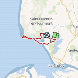

Length
13.9 km

Max alt
12 m

Uphill gradient
40 m
Km-Effort
14.4 km

Min alt
-1 m

Downhill gradient
40 m
Boucle
Yes
Creation date :
2014-12-10 00:00:00.0
Updated on :
2014-12-10 00:00:00.0
1h55
Difficulty : Easy

FREE GPS app for hiking
 SityTrail
IGN / Geographical institutes
SityTrail Plus
The world is yours!
About
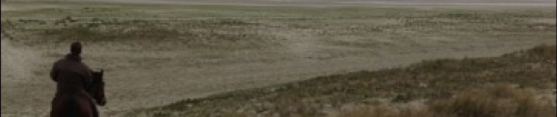
Trail Equestrian of 13.9 km to be discovered at Hauts-de-France, Somme, Le Crotoy. This trail is proposed by ioudina.
Photos


Positioning
Country:
France
Region :
Hauts-de-France
Department/Province :
Somme
Municipality :
Le Crotoy
Location:
Unknown
Start:(Dec)
Start:(UTM)
401122 ; 5567402 (31U) N.
Comments